Cody Williams
AP Environmental Science ♻️
252 resourcesSee Units
El Niño
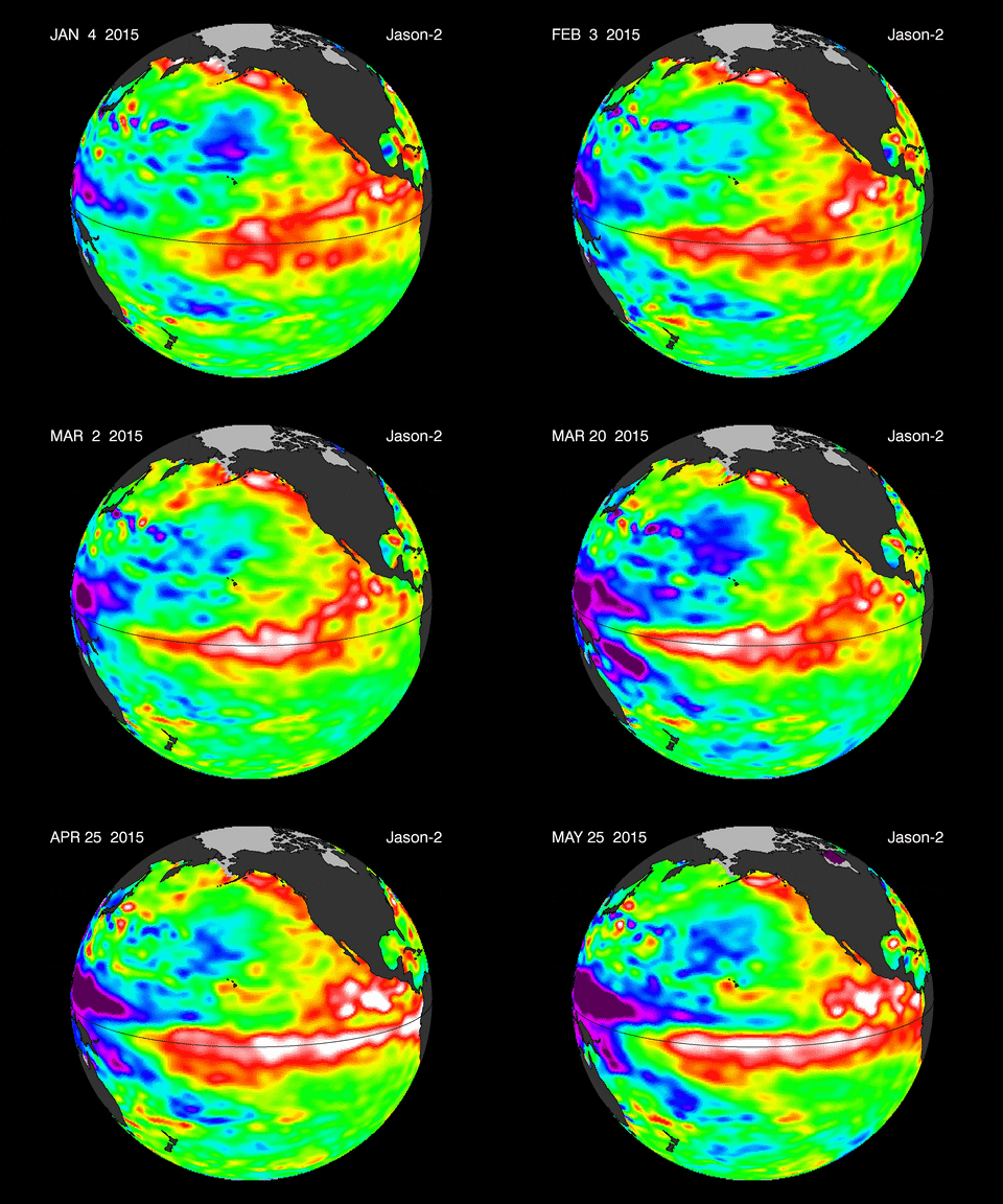
An El Niño is a warming of the Pacific Ocean between South America and Papua New Guinea (just north of Australia, an island in the Southwest Pacific). This occurs when the trade winds in that region weaken, which causes the west coast of South America to experience warmer waters. This effect also allows the thermocline to move deeper. This layer of the ocean represents a shallow depth at which a lot of heat is lost. By moving deeper, this demonstrates that the thermocline has receded into the depths and given rise to more warm ocean. This is shown in the image below. El Niño events cause higher precipitation in drier climates on the West Coast but create colder winters in the southeastern US.


La Niña
When a La Niña occurs, it is a cooling of the Pacific Ocean between Papua New Guinea and South America, essentially the opposite of an El Niño. The formation of a La Niña begins when the trade winds get stronger, which pushes warm coastal water further and further away from the South American coastline. Deeper and colder water from the ocean will rise, which is called upwelling. This means that the thermocline has instead moved up, creating less room for warm ocean.
Instead of generally rising temperatures, we see cooler temperatures as well as wet conditions. However, in the southeastern US, we see the opposite, warmer and drier conditions.
Greater Environmental Impacts
An El Niño can have impacts that are shown around the world. The rapid change in climate may cause some species to suffer or require relocation due to their niche not allowing for extremely warm or cold environments. Additionally, migration seasons for birds may change entirely.
On a more global scale, the ocean heat capacity decreases and it is unable to absorb as much energy as needed, which in turn warms the planet. As for the weather, temperature changes will affect precipitations and contribute to either flooding or drought.
Browse Study Guides By Unit
🏜Unit 1 – The Living World: Ecosystems
🐠Unit 2 – The Living World: Biodiversity
👪Unit 3 – Populations
🌏Unit 4 – Earth Systems & Resources
🏖Unit 5 – Land & Water Use
⚡️Unit 6 – Energy Resources & Consumption
💨Unit 7 – Atmospheric Pollution
♻️Unit 8 – Aquatic & Terrestrial Pollution
🔥Unit 9 – Global Change
📚Study Tools
🤔Exam Skills

Fiveable
Resources
© 2025 Fiveable Inc. All rights reserved.